Project Overview
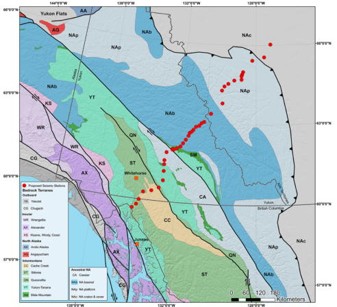
The Mackenzie Mountains EarthScope project is a 5-year National Science Foundation funded project aimed at exploring the origins of the Mackenzie Mountains in the Northwest Territories of Canada. The Mackenzie Mountains are one of a unique group of mountain ranges throughout the world formed great distances from tectonic plate boundaries. Understanding these range’s origins is of great scientific interest as there is not currently a scientific consensus to explain this phenomenon.
The $1.1M project is being led by Geosciences Assistant Professor Derek Schutt and co-principal investigators Department Head and Professor Richard Aster and Professor Jeff Freymueller of the University of Alaska Fairbanks.

With partner, Joel Cubley of Yukon College, the project will engage undergraduate students from Yukon College, a 2-year college in Whitehorse, Yukon, to perform fieldwork and data collection. Students from the college will be extremely valuable to the effort due to their local knowledge of the area and experience working in the Territory’s challenging environment. In turn they will gain valuable experience and new insights into careers and research opportunities available in the field of geosciences.
The research team is also glad to collaborate with researchers in Canada and elsewhere to take maximal advantage of the special opportunity enabled by the presence of this temporary array. Collaborators include scientists Juan Carlos Afonso, Pascal Audet, and Stéphane Mazzotti, and partner agencies include the Northwest Territory Geosciences Office.
If you have questions about the project please contact Derek Schutt.
(970) 491-5786 Derek.schutt@colostate.edu


