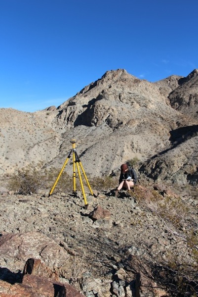
Facilities available in the department and on campus include:
- X-ray diffractometer
- Radiogenic isotope labs
- Stable isotope labs
- Gas chromatograph
- Scanning electron microscope (SEM)
- Fluid lab
- Rock preparation and processing facility
- Faro Focus3D terrestrial laser scanner (ground-based LiDAR)
- Topcon GR5 differential gps system for high accuracy RTK surveying
- Geophysical field equipment (including ground penetrating radar, multi-channel electrical resistivity and induced polarization system, multi-channel seismic system, and gravity meter)
- The Edward M. Warner Spatial Analysis Lab (SAL) – equipped with state of the art software for geochemical modeling; structural analysis; Geogra
phical Information Systems; seismic surface wave, reflection, and refraction data processing and interpretation; potential field and resistivity/IP data processing and interpretation; and numerical and mathematical modeling of tectonic, geodynamic, and hydrogeological problems. - Olympus hand-held XRF: Application Form, Detection Limits

Item: Olympus hand-held XRF
Location: –
Dept. Contacts: Jerry Magloughlin, John Singleton
Policy: https://warnercnr.colostate.edu/wp-content/uploads/sites/2/2016/10/XRF_USE_document_v4.pdf
Description/Status: https://warnercnr.colostate.edu/wp-content/uploads/sites/2/2016/10/Peridoic_Table_And_Detection_Limits.pdf
Item: SfM Software and Computers
Location: SAL Lab
Dept. Contacts: –
Policy: See website for policy and to sign up for time. Preference for teaching courses working with Sfm, followed by students who need to process Sfm imagery. https://csugeosciencessfm.home.blog/
Description/Status: –
Item: Emlid RS2 GNSS Receivers (6 total)
Location: MS 319
Dept. Contacts: Dan McGrath
Policy: Complete request form:
https://docs.google.com/document/d/14bkrCiiLZOi0YwUKGQCx4XvcbU4
Fg7F_KkTIPA7SZ9k/edit?usp=sharing
Description/Status: Six Emlid RS2 GNSS receivers (3 pairs) with tripod/monopole/iPad minis
Item: DJI Mavic 2 Pro drone + batteries
Location: MS 319
Dept. Contacts: Dan McGrath
Policy: –
Description/Status: –
Item: DJI RTK Phantom4 drone + batteries
Location: Drone Center
Dept. Contacts: Dan McGrath
Policy: https://www.research.colostate.edu/csudronecenter/services/
Description/Status: Includes base station and drone; rental fees apply
Item: SAL
Location: MS 311
Dept. Contacts: –
Policy: geosciences@colostate.edu
Description/Status: Department general contact
Item: Thin Section Slide Scanner
Location: –
Dept. Contacts: –
Policy: –
Description/Status: –
Item: DIONEX IC-6000
Location: MS 306B
Dept. Contacts: Jeremy Caves Rugenstein
Policy: Request by email
Description/Status: Awaiting delivery (11/21)
Item: Picaro Water Analyzer
Location: EcoCore Lab/NESB
Dept. Contacts: Jeremy Caves Rugenstein
Policy: Per sample charge
Description/Status: Awaiting approval of rates from CSU Business Office — otherwise working (12/21)
Item: GasBench/Delta V Mass Spec
Location: EcoCore Lab/NESB
Dept. Contacts: Jeremy Caves Rugenstein
Policy: Per sample charge
Description/Status: Awaiting characterization of standards (12/21)
Item: AIRIE Facilities
Location: MS 117
Dept. Contacts: Holly Stein
Policy: Independently Contracted; http://www.airieprogram.org
Description/Status: Re-Os Geochronology and Os Isotope Tracer Studies Applied to Sulfides, Black Shales, and Hydrocarbons; http://www.airieprogram.org
Item: Cathodoluminescence System
Location: MS 321
Dept. Contacts: John Ridley
Policy: Request by email
Description/Status: In Setup (11/21)
Item: Research Microscopes
Location: MS 321
Dept. Contacts: John Ridley
Policy: Request by email
Description/Status: –
Item: Geometrics Geode seismic system
Location: MS 319
Dept. Contacts: Dan McGrath
Policy: Request by email
Description/Status: Details are here
Item: S&S PulseEkko Ground Penetrating Radar system
Location: MS 319
Dept. Contacts: Dan McGrath
Policy: Request by email
Description/Status: Details are here
Item: Syscal Prop 48 Channel Electrical Resistance Tomography system
Location: MS 319
Dept. Contacts: Dan McGrath
Policy: Request by email
Description/Status: Details are here
Item: Gravity Meter
Location: MS 306C
Dept. Contacts: Dennis Harry
Policy: Request by email
Description/Status: –
Item: Digital Elevation Sandbox
Location: MS 338
Dept. Contacts: Sean Bryan
Policy: Request by email
Description/Status: –
Item: Department Sat. Phone
Location: MS 324
Dept. Contacts: Patti Uman/Ashley Walters
Policy: Reserve through department office
Description/Status: Iridium comms
Item: Department InReach Mini
Location: MS 324
Dept. Contacts: Patti Uman/Ashley Walters
Policy: Reserve through department office
Description/Status: Iridium comms
Item: Raspberry Shake Seismographs
Location: MS 324
Dept. Contacts: Rick Aster
Policy: Reserve through department office
Description/Status: https://manual.raspberryshake.org
Item: DJI Mavic2 drone + batteries
Location: MS 327
Dept. Contacts: Sean Gallen
Policy: Request by email
Description/Status: –
Item: DJI Phantom4 drone + batteries
Location: MS 327
Dept. Contacts: Sean Gallen
Policy: Request by email
Description/Status: –
Item: LaserPulse laser range finder
Location: MS 327
Dept. Contacts: Sean Gallen
Policy: Request by email
Description/Status: –
Item: Cosmogenic nuclide preparation lab
Location: MS 323
Dept. Contacts: Sean Gallen
Policy: Request by email
Description/Status: Chemical mineral separation to isolate pure quartz
Item: Drying oven
Location: MS 323
Dept. Contacts: Sean Gallen
Policy: Request by email
Description/Status: –
Item: 4 ultrasonic tanks
Location: MS 323
Dept. Contacts: Sean Gallen
Policy: Request by email
Description/Status: –

